Honey’s Dreamland
NOTES FROM ABOVE GROUND
By Honey van Blossom
(Honey is a Belgian Marxist former strip-tease artiste)
After exposure to sunlight, Kodachromes taken with home cameras in the 1940s and 1950s lost color, becoming fainter. Memory may also turn colors fainter after a time. The colors in the first dream are paler than colors are in real life.
The place was near a lake or marsh. Tall reeds grew at the water’s edge, and the boy hid in them. Women were on an elevation behind above him, and the slope of land and brush concealed them from him. The women sang as they worked. They gathered seeds. They were all safe.
Partly concealed by the brush stood a rabbit that watched the boy without moving. The rabbit had long upright ears that were thin so that the light made them translucent. One of the women called the boy by his other name, not his real name. The boy’s other name was rabbit.
A smooth stone lay in the shallows. The child put his hand in the water and removed the stone. His hand was brown not white. I knew I was dreaming and woke. Read more
Honey Continues to Live in Concord, California
NOTES FROM ABOVE GROUND
By Honey van Blossom
(Honey is a Belgian Marxist former strip-tease artiste)
My house is one of perhaps thirty 1956 houses at the edge of the Canterbury Village subdivision. The thirty houses are regular square houses. Most of the true Canterbury houses are two stories with steep roofs and a brick chimney.
There is no village in Canterbury Village. There are houses and on the nearest main streets commercial businesses but the word “village” does not describe our neighborhood.
The streets of the Canterbury Village are named Shakespeare, Hamlet, Romeo and Juliet, Cape Cod (no cape, and no cod), Chaucer Drive, Pickwick Drive, Lancelot, Churchill, Cobblestone Drive. I live on Shakespeare.
I thought for years that the three men that live on Shakespeare Drive were the same man but recently have been able to distinguish them. They all wear very long gray-brown beards, baseball caps, are stocky, and they all walk in a hunched way as if they had serious back injuries at one time, and maybe they all did. One, however, rides a motorcycle, and another one rides a convertible and plays the same song over and over loudly. The other one just stands at the edge of his lawn. They emerge from different houses. Read more
Honey Talks About Two journeys through California from Los Angeles in 1912
NOTES FROM ABOVE GROUND
By Honey van Blossom
(Honey is a Belgian Marxist former strip-tease artiste)

1912 driving costume.
An Englishman named J. Smeaton Chase settled in Southern California in 1890, when he was twenty-six. The best known of Chase’s books is California Coast Trails: A Horseback Ride from Mexico to Oregon, published when he was forty-seven about his travel on horseback on trails from San Diego to the Oregon border wearing a broad-brimmed Stetson hat, riding breeches, leather puttees and a tweed coat.
From Chase’s California Coast Trails:
“Carl Eytel the painter and I were riding down the south road from El Monte one midsummer morning, with our blankets rolled behind our saddles and other appurtenances of outdoor living slung about us. Ever since I had lived in California I had been waiting for an opportunity to explore the coast regions of the State. At last the time had come when I could do it; and Eytel, my companion on other journeys in the mountains and deserts of the West, was free to join me for the southern part of the expedition.
“Our object was to view at our leisure this country, once of such vast quiescence, now of such spectacular changes. Especially we wished to see what we could of its less commonplace aspects before they should have finally passed away: the older manner of life in the land; the ranch-houses of ante-Gringo days; the Franciscan Missions, relics of the era of the padre, and the don, the large, slow life of the sheep and cattle ranges, and whatever else we could find lying becalmed in the backwaters of the hurrying stream of Progress.” Read more
Honey finds where the Portola monument should be
NOTES FROM ABOVE GROUND
By Honey van Blossom
(Honey is a Belgian Marxist former strip-tease artiste)
One Sunday morning, river activist, urban adventurer and Los Angeles County Beach Commissioner Anthea Raymond and I met at Nick’s Café. Our mission for that day was to look for the real site of the August 2, 1769 Portola expedition’s campsite.
Gaspar de Portolá i Rovira led the first European land exploration from San Diego to San Francisco. Father Juan Crespi accompanied the expedition, and it was either from the campsite or very near it that he saw the land he recommended for a mission and large settlement, which became the City of Los Angeles.
Nick’s Café is at 1300 North Spring Street in an area that was probably alongside the agricultural lands first established in the grasslands Father Crespi saw.
The zanja (irrigation ditch) that probably nine of the pobladores – two of the eleven men were described as “useless” — built in the late summer and early fall of 1781 went through the area popularly called “the Cornfield,” now the Los Angeles State Historic Park, and before that, beginning in 1876, the Cornfield was occupied by the Southern Pacific train yard. In the early 1850s, the land was comprised of deeded land after E.O.C. Ord’s August 1849 survey. Before the 1850s, the land was comprised of farms. Read more
Honey Talks About the first plaza in Los Angeles and the unsettling wind
NOTES FROM ABOVE GROUND
By Honey van Blossom
(Honey is a Belgian Marxist former strip-tease artiste)
In Los Angeles, the disagreeable Santa Ana winds originate inland. Raymond Chandler, in “Red Wind”:
“There was a desert wind blowing that night. It was one of those hot dry Santa Anas that come down through the mountain passes and curl your hair and make your nerves jump and your skin itch. On nights like that every booze party ends in a fight. Meek little wives feel the edge of the carving knife and study their husbands’ necks. Anything can happen. You can even get a full glass of beer at a cocktail lounge.”
Many of the streets in downtown Los Angeles are cocked at an angle. They run north-northeast to south-southwest instead of north to south, east to west. Streets begin to run north to south at Hoover. Unsettling winds might be the explanation for why streets around the plaza downtown are set at an angle. Or not.
Raymond Chandler’s plots were so convoluted even he couldn’t always follow them.
The plot of the mystery of why Los Angeles streets run at an angle is as serpentine as a Chandler story.
The simple solution to the street mystery is that the plaza next to the Olvera Street marketplace downtown – laid out between 1825 and 1830 – was cocked at an angle during the years when the plaza was a rectangle. The plaza’s left top corner pointed north, which meant that the streets established after the plaza was laid out followed the plaza’s angle. Read more
Honey Talks About Brentwood, the birthplace of American California
NOTES FROM ABOVE GROUND
By Honey van Blossom
(Honey is a Belgian Marxist former strip-tease artiste)

Marsh murder site stone
A big rock stands on the right hand side of Pacheco Road as you drive from Martinez. Low yellow hills lie on each side of Pacheco Road at that location. A metal plate on the rock reads: “Dr. John Marsh California Pioneer murdered here September 26, 1856.”
Dr. Marsh was on his way from his Rancho Los Meganos to Martinez in his horse and buggy that day, headed for San Francisco.
He may have followed a road – all roads were dirt then –from today’s Antioch to today’s Willow Pass Road to some road that wound through what would become Todos Santos (today’s City of Concord) and then down to a road that led to Martinez.
His route, whichever he took, from Rancho Los Meganos was one that passed through unfenced ranchos where cattle roamed. The City of Concord did not yet exist. Pacheco did not exist. Walnut Creek was still “Four Corners,” a meeting of roads near the bottom of the western flank of Mt. Diablo.
He may have intended to get from Martinez to San Francisco by a water route. Paddle wheel steamboats traveled between San Francisco and Sacramento since 1850 with a stop at Benicia, and a ferry opened between Martinez and Benicia in 1850.
San Francisco was a relatively new city in 1856. It was incorporated as a city in 1850. Prior to 1835, no one other that Ramaytush Indians lived north of Mission Creek, the creek that once reached inland to the mission, although Ramaytush villagers had lived there before the mission and presidio were built (1776).
Dr. Marsh had arrived in California on the Santa Fe Trail and lived for a year in the then newly incorporated Mexican city of Los Angeles, working as a doctor. Read more
HONEY TALKS ABOUT WHERE LOS ANGELES BEGAN, PART 3
NOTES FROM ABOVE GROUND
By Honey van Blossom
(Honey is a Belgian Marxist former strip-tease artiste)
Over the course of the summer of 1781, twenty-one men and women and twenty-three children walked from the San Gabriel Mission. They had been exposed to smallpox during the time they were in Baja California. They made the walk in small groups.
The two or three groups of colonists forded the Los Angeles River at the place where the Broadway Bridge now crosses it but then the river took a different path from the channel created for it by the United States Army Corps of Engineers a century and a half later.
The river then was a real river, and beneath it through the land ran subsurface waters that sometimes broke through the earth in springs. Fish swam in the river. Herons with their long necks uncoiled cast shadows of their wings on the surface of the water.
The families reached a ledge or mesa or hill terrace above the river near the crossing place in the river. Native men arrived from the village of Yang Na about a mile and a half away and helped the settlers build jacals from sticks and reeds to live in for the next few years. Read more
Honey Talks About Where Los Angeles Began. Part 2
NOTES FROM ABOVE GROUND
By Honey van Blossom
(Honey is a Belgian Marxist former strip-tease artiste)
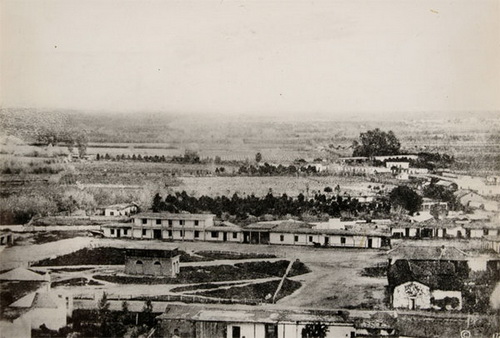
Part 1 of “Where Did Los Angeles Start?” looked at the primary Tongva trading village of Yang-Na, located about where the Los Angeles Civic Center is today. Part 2 describes Los Angeles as the first emigrants from the United States saw the pueblo (until 1835) and then as they saw the city (after 1835).
In Edgar Allen Poe’s short story “The Case of The Purloined Letter,” police detectives search for a stolen letter. They look behind wallpaper and examine tables and chairs with magnifying glasses, but they cannot find the stolen letter in the hotel room where the blackmailer/thief stays. The fictional private detective C. August Dupin later finds the letter hidden in plain sight hanging on a ribbon used to hold letters but with a handmade envelope that had nothing to do with the letter inside.
The website for Olvera Street calls it “the first street in Los Angeles.” It wasn’t. The first streets were called “o” and “n.” Olvera Street was called Wine Street until 1877. If you drive to that tourist marketplace called Olvera Street today along Sunset headed towards Terminal Annex, however, a road sign next to the market place states, “Olvera Street. Established 1930.” The city both misleads you and sets you straight.
California historians place the original pueblo proper (the plaza and surrounding structures) in different places: on top of the Indian village of Yang-Na, at El Aliso, the giant sycamore, “behind Union Station,” around the Twin Towers jail on Vignes, and on the hill a bit above the present pueblo at about Parking Lot No. 2. A couple of writers gave up trying to figure it out. Read more
Honey Talks About Where Los Angeles Began, Part 1
NOTES FROM ABOVE GROUND
By Honey van Blossom
(Honey is a Belgian Marxist former strip-tease artiste)
Introduction
“128. When it began, Los Angeles had no riverfront, harbor, or highway to somewhere else more important. Before Colonel de Neve opened his notebook and drew a plan showing house lots around a plaza and the church, Los Angeles had no explanation.” D. J. Waldie, Holy Land: a Suburban Memoir (St. Martin’s Griffin`1996).
Waldie’s misunderstandings about the birthplace of Los Angeles are common among those that think about it at all. Neve did not open a notebook and draw a plan. Before the Spanish pueblo of Los Angeles was founded in 1781, no one needed somewhere else more important to go to because the idea of somewhere else more important would have been incomprehensible to anyone living in the region, except possibly the padres of the two missions, but the padres were dedicated to conversions of the native people to Catholicism.
Los Angeles began as far as we now know in a large native village that was near, perhaps partly under, where City Hall now stands and extended to today’s Fletcher Bowron Square.
Felipe de Neve was governor of the Californias when he organized the founding of the Pueblo de la Reina de Los Angeles in 1781, although it is true that he earned the rank of colonel in 1774.
José Darío Argüello (1753-1828) drew a map in 1786 of the pueblo as it was five years after its founding.. https://www.kcet.org/lost-la/the-first-map-of-los-angeles-may-be-older-than-you-think. (Retrieved 6/17/2016). This link takes you to the map translated into English. https://www.kcet.org/shows/lost-la/happy-birthday-los-angeles-but-is-the-story-of-the-citys-founding-a-myth. (Retrieved 6/17/2016) Under Neve’s orders, Argüello had led the first ten Los Angeles pobladores to the site of the pueblo that grew into Los Angeles in June 1781. Read more
Honey’s literary travels by train
NOTES FROM ABOVE GROUND
By Honey van Blossom
(Honey is a Belgian Marxist former strip-tease artiste)
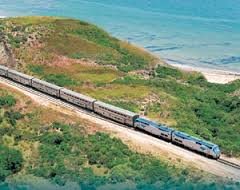
The names of Amtrak’s train cars painted on the sides carry messages of places that have geographic and historic meaning, e.g., “Yolo River,” “Monterey Bay,” “Yosemite River,” “Owens Valley,” “Drakes Bay.” Describing the train routes to and within California compresses the landscape of this state’s literature.
The literary traveler that arrives in California by train may take the Zephyr, which runs daily between Chicago and San Francisco, coursing through the plains of Nebraska to Denver, across the Rockies to Salt Lake City, through Reno and the Sierra Nevada Mountains, through Reno and Sacramento into Emeryville. The California Zephyr connects to San Francisco by Thruway Bus Service at Emeryville. Where the Zephyr’s passage over the Sierras passes through Truckee the train roughly follows one of several routes taken by the emigrants — Americans coming into California – before there were roads.
In May 1827, forty-two years before the Transcontinental Railway reached California, Jedediah Smith, born in 1799, and his party of 15 other men crossed the Sierra Nevada (west to east). They sheltered in a Mojave village near present-day Needles, California. Two runaway Indians from the Spanish missions guided them into the Mojave Desert along the Mojave Trail, the western portion of the Old Spanish Trail. This trail began as an ancient Native American trail. Read more


